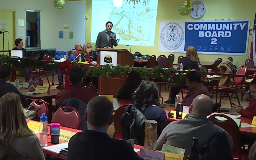
Jason Loiselle, principal at Sherwood Design Engineers and a consultant for YourLIC, discusses flood resiliency at Community Board 2 last week
Jan. 10, 2020 By Christian Murray and Michael Dorgan
Consultants for a group of Long Island City property owners that plan to develop a large tract of waterfront property presented plans before Community Board 2 last week outlining where park space is likely to go and how they plan to combat flooding.
Four developers are trying to put together a united vision for a 28-acre area near Anable Basin, which includes land where Amazon’s New York headquarters was expected to go.
The property owners are currently working on a masterplan for the area and have started the process by looking at potential greenspace and flood resiliency—with the bigger issues of how much residential and commercial space will be built to be addressed later.
The City Council is calling on the owners to come up with a comprehensive masterplan for the area which is bound by the Con Edison site to the north, Queens West to the south and Vernon Boulevard to the east. The city wants the developers to come up with one united plan as opposed to producing their own separate concepts.
In November the property owners formed YourLIC, providing a mechanism for the public to weigh in as they formulate a comprehensive plan. Through YourLIC, the developers have hired consultants who are currently holding public workshops as a means to get feedback.
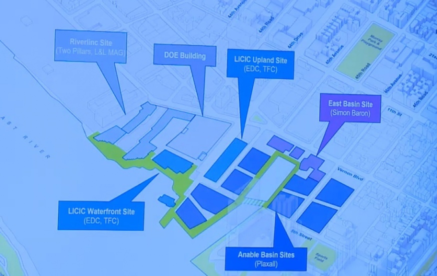
The 28-acre area primarily consists of private property although there are two city-owned sites on 44th Drive as well as the Department of Education property. The two city-owned sites are being overseen by the Economic Development Corp. and developed by TF Cornerstone.

The development sites that make up the 28-acres. The EDC sites and DOE building are publicly owned (Source: YourLIC)
The privately-held sites are owned by L&L MAG, Simon Baron Development and Plaxall.
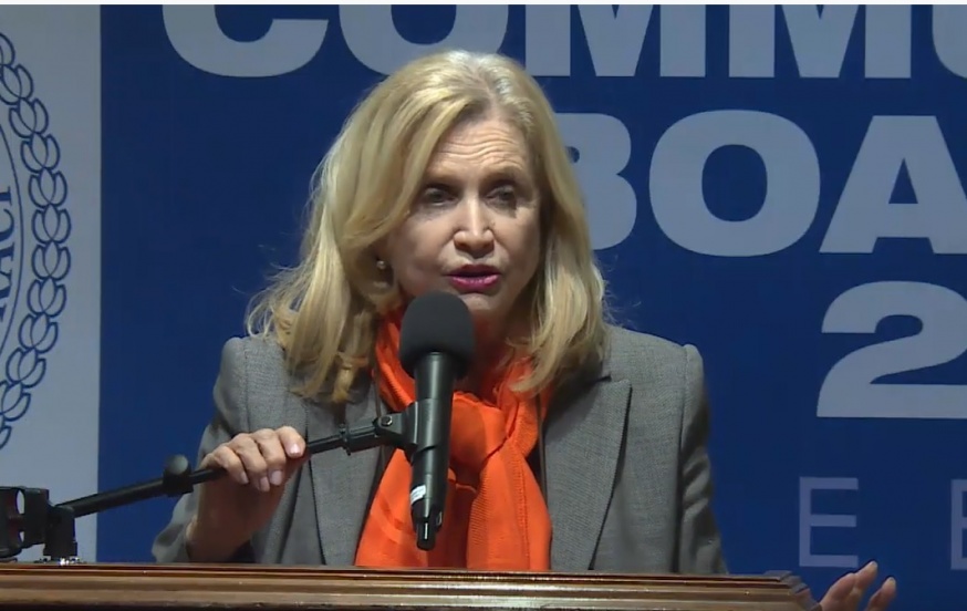
Congresswoman Carolyn Maloney, who spoke before the presentation, said that the public land should be used for a public purpose.

Congresswoman Carolyn Maloney at CB2 meeting last week
“If I were on this community board I would be putting out a resolution that we should take the public land and turn it into a park for public use,” Maloney said.
Maloney added that the 28 acres provide an “extraordinary opportunity” for the community, which could bring parks, schools and a resiliency plan to protect the neighborhood from the next hurricane.
The YourLIC consultants—from SHoP Architects, Sherwood Design Engineers and SCAPE Landscape Architecture–presented plans for greenspace as well as flood mitigation, noting that the area is vulnerable to coastal and rainwater flooding.
John Barrett, project director at SHoP Architects, told the board that the development group is looking into creating a plan that would bring open space linking the entire waterfront. They aim to provide waterfront park space that would connect from Gantry Plaza State Park although the way past the Con Edison site.

Map indicating the potential connectivity of the waterfront
Gena Wirth, design principal at SCAPE Landscape Architecture, told the board that about seven-to-eight acres of the 28-acres is likely to be used for public open space. She identified a range of possible uses– from lawn space, sports fields, plaza space, playground space, overlooks, dog runs, markets, walkways and board walks.
The waterfront greenspace would help—along with barriers and other design concepts—combat coastal flooding, according to Jason Loiselle, a principal at Sherwood Design Engineers, who presented at the meeting. He noted that the area will be more susceptible to flooding as sea levels rise and storm activity increases.
In fact, without flood mitigation, he said, the land at the end of 44th Drive. would be under water during a standard high tide by 2050 due to glacial melting.
However, he said the development site would be elevated and other measures adopted to prevent this.
But the consultants gave no indication as to what buildings were being planned for the swath of land.
Many board members said it was difficult to give feedback on the open space plans without knowing what will ultimately be developed there.
“I’m noticing the beautiful presentation of open space and parkland but we don’t see images of the actual buildings–and the density and the height of the buildings–that will go right behind these open spaces,” said Kenny Greenberg, a Long Island City resident and community board 2 member.
“We are not getting a clear picture of the relationship between the properties and open space,” Greenberg added.
Board member Christine Hunter said it was difficult to assess the resiliency component and open space concept without knowing where the residential buildings will go and how many there will be.
The question of who will own and manage the open space was raised by board member Jacob DeGroot.
Wirth said the open space will be privately owned but open to the public. She said the space would be regulated by the city and the public would have a say on its design.
Meanwhile, board member Thalia Batan asked if there could be more open space than the seven to eight acres.
Loiselle, of Sherwood Design, responded by saying that there was only so much open space that could be offered given the economics of the project.
“Our goal of seven to eight acres is above and beyond the open space requirements,” Loiselle said, adding that “there is a balance as to the economic viability of the development with what can be invested in resiliency and open space.”
Additionally, Wirth said that the public is likely to get more open space because the four developers have come together—and that the open space will be contiguous.

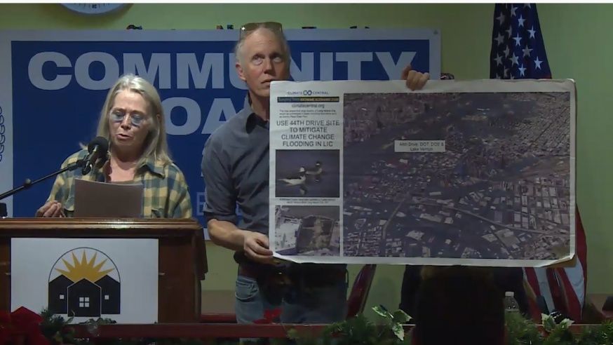
Diane Hendry, a member of the LIC Coalition, speaking at the CB2 meeting
During the public comments segment, Diane Hendry, a member of the LIC Coalition, called for the city-owned sites on 44th Drive to be used for public purposes as opposed to being developed by TF Cornerstone.
She advocates for these parcels to be turned over to a community land trust, a concept where non-profit organizations own the land and then lease it at affordable levels for residential and commercial use.
Hendry called on TF Cornerstone to “walk away from this parcel and support a Community Land Trust at the DOE and DOT sites, with the rest of the 44th Drive becoming resiliency and open space sponge park.”
She also advocated for the city to buy the property owned by L&L Mag, noting the Community Board 2 had been advocating this for years.
Tom Paino, a Long Island City resident and former sustainability director at the New York Department of Design and Construction, said that the developers are driving the discussion and greater advocacy is needed from the public.
“This is all coming from the developers,” Paino said.
However, a number of residents—members of the Western Queens Land Trust– have formed their own group to discuss the future of the 28 acres.
Memo Salazar, a representative of the trust who spoke at the meeting, said that they have created a group called ourlic, complete with a website at ourlic.nyc , and have already put together some of their own concepts, which include a school, rooftop farm and commercial kitchens. The group will be holding a meeting at the Jacob Riis Center at 1025 41st Ave on Jan. 21 at 6:30 p.m. to discuss their plans.
The next Your LIC workshop—which will be the third to date—will focus on schools, recreation and culture. It will be held on Jan. 27 at 6 p.m. at the Plaxall Gallery, located at 5-25 46th Ave.
Residents are encouraged to send their ideas concerning this workshop and other suggestions to YourLIC.com

The sites that make up the 28 acres being discussed as part of YourLIC
One Comment

The most vulnerable need help…. build housing for the homeless…. build a center to help transition homeless individuals from shelters to homes…. We are at a crisis in NYC…. Let’s use the public land to help this population!