Aug. 14, 2015 By Jackie Strawbridge
The City is examining the dock site just across Anable Basin from Gantry Plaza State Park, for the Long Island City stop on the incoming Astoria-to-Wall Street ferry line.
This ferry line will be one of five slated to open between 2017 and 2018 as part of a City-wide plan announced earlier this year. It will run from Hallets Cove in Astoria to Roosevelt Island, to Long Island City, to East 34th Street and Wall Street in Manhattan.
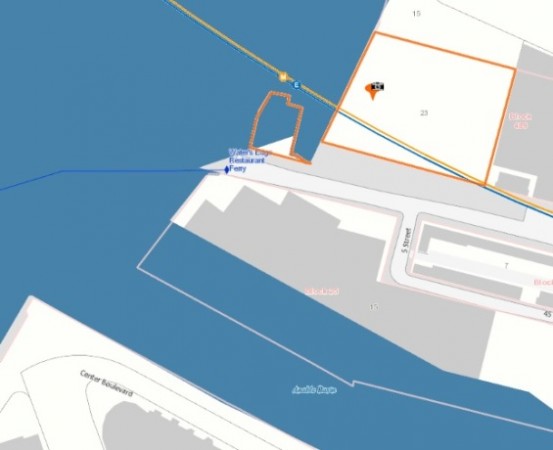
The Hunters Point South dock will remain and its existing Queens/Brooklyn/Manhattan route will be unchanged (see map).
The City Economic Development Corporation has identified the waterfront edge of 44th Drive – on the north side of Anable Basin, across from Gantry, near the Water’s Edge restaurant – as a potential site to construct the Long Island City North ferry dock, a spokesperson confirmed.
Paula Kirby of Plaxall, which owns property next to the proposed dock site, said she is “excited” for the potential new neighbor.
“We certainly thought it was a great idea to have more transportation between Long Island City and Manhattan,” she added.
Plans for the City’s new ferry lines are still in the early stages; the project is expected to require multiple agency approvals and zoning waivers, according to documents from the Mayor’s office.
Next month, four public meetings will take place regarding the environmental impact of the City-wide ferry service project, including the potential Long Island City dock.
A Queens meeting will take place Sept. 16 at Queens Borough Hall, 120-55 Queens Blvd. in Kew Gardens, at 6 p.m.

9 Comments


Would be really great if they connected this new line to LGA eventually!!
Guess what there are a lot of people who live in the rest of the neighborhood! They are now building inland and this will be much more convenient for those who live around court square and queens plaza. If they include parking they would also get people who commute from Long Island and eastern queens. Not everyone lives down at the waterfront.
Who’s going to walk from Queens Plaza to the river? I actually think the stop should be at the inlet to the Newtown Creek, to help handle the thousands of people there who will face a very long walk to Vernon Jackson.
The current LIC location is quite convenient to the quickly growing neighborhood. If they move this to north of Anable basin, there will need to be a foot bridge connecting from the park so people will not have to walk so far around. If not, I will have to stop using that beautiful service.
They’re still going to keep the current location, but add this one Lynn.
It would be interesting to include a footbridge over the inlet to connect that part of the area to the rest of the waterfront.
Would also make trips to Anabel easier.
This location isn’t really near any major residential housing, but if it keeps it away from the towers (and the horn blowing that the ferries are legally required to do), I’m all for it.
This would be fantastic news! I was really hoping for a stop that was north of the Hunters Point North stop that the Waterway was currently planning.