Oct. 9, 2015 By Christian Murray
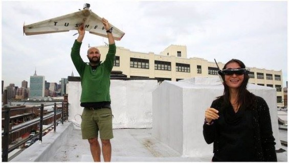
This summer, Long Island City resident Georgi Tushev attached a camera to one of his drones, flew it for 40 minutes and put together a breathtaking video of neighborhood.
“It took me half a day,” Tushev, an artist, said nonchalantly. “It was the result of four flights and then editing the footage down.”
The video is six minutes long and covers the entire Long Island City area—from Queens Plaza to Newtown Creek.
Tushev, who has lived near Anable Basin for the past eight years, is no novice when it comes to flying drones and capturing aerial footage. He has been working with his wife, Nina, taking footage all around the world—from Italy to Peru—for years.
His passion for remote-control airplanes developed in the early 2000s and was largely a hobby. He would build the planes himself and then take them to the roof of his Long Island City building and test them out.
“The first one crashed,” he said. “The second one crashed and then I started looking for materials and ways to make them work.”
Tushev, whose father was a rocket engineer in Bulgaria, said that he has always had a passion for aviation. He said as a child he would often fly toy planes.
Today he invents tools and gadgets that have helped him design his drones. He then attaches a tiny camera on top of them to capture the footage.
In 2008, Tushev made his first video, which he described as grainy.
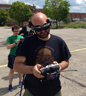
In the beginning, he would control the drone by monitoring its flight path with the naked eye from his roof.
However, about two years later, he was able to attach a camera that would transfer a live feed of the flight path to him through goggles as if he were in the cockpit of the drone itself. This provided him with much greater control and the ability to take superior footage.
With this advancement, he has been able to shoot footage of some of the most dazzling places on earth.
But the days of being strictly a hobby are over since his wife took an interest and saw its application for her work.
Nina, also from Bulgaria, works at the United Nations and is involved in protecting the rights of indigenous people and the environment. As part of that work, she monitors deforestation in Central and South America.
Tushev has been taking aerial footage for non-governmental organizations (NGOs) in countries such as Peru and Panama. His videos are used to track deforestation or damage caused by oil spills. In January they are going to Honduras on a similar mission.
Nina said that their goal moving forward is to continue to use drones to fight for the environment and indegious people. She said that the footage “provides communities with the evidence they need to protect their territories.”
They are also in talks with the scientific researchers to use their drones to monitor carbon in trees.
“Essentially, we want to continue to use drones for the good,” Nina said.
The following video is from 2008.
3 Comments


Love this!
super cool!! Can u do Astoria next time vs LIC??
Wow. Great stuff.